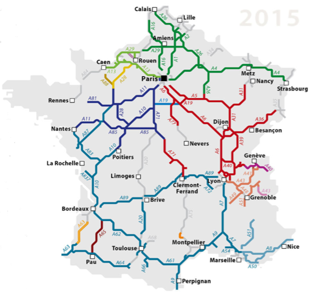
The French motorway network is a road network composed of 142 motorways at the beginning of 2016, comprising 9,112 km of concession lanes, including 68.1 km of toll bridges and tunnels, for a total of at least 11,882 km in 2014. The France has the fourth longest motorway network in the world after those of China, the United States and Germany (12,917 km in 2013).
Source : http://routes.wikia.com
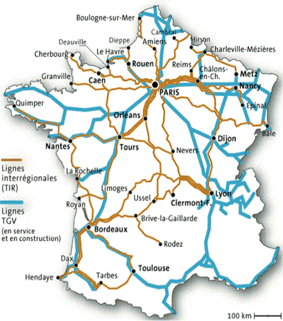
Major railway lines
The second largest European rail network in terms of length, operates 30,000 km of lines in service that irrigate the entire national territory, including 884 km of high-speed lines.
Source : SNCF/GART
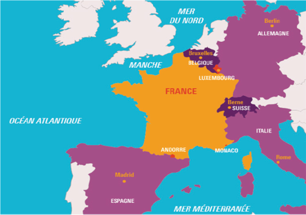
The borders of France
Source : http://education.francetv.fr
The natural boundaries of metropolitan France
The borders of the Metropolitan France are as much maritime (3,400 km) as terrestrial (3,000 km). It has 4 maritime facades: the North Sea and the English Channel to the north, the Atlantic Ocean to the west and the Mediterranean Sea to the south. Some of its land borders are natural: a river (the Rhine to the east) or mountain ranges (the Jura and the Alps to the east, the Pyrenees to the south). Located in the Mediterranean Sea, Corsica is also part of metropolitan France.
Metropolitan France and its neighbours
Metropolitan France shares its land borders with 8 countries: Belgium and Luxembourg to the north, Germany and Switzerland to the east, Italy to the southeast, Monaco, Andorra and Spain to the south.